Trail Cycle Saint Vith - traca-gpx-les-balades-va-lo-de-la-a-ta-la-forei-t-da-ommerscheider-3277 - Photo

traca-gpx-les-balades-va-lo-de-la-a-ta-la-forei-t-da-ommerscheider-3277

© OpenStreetMap contributors
Length
Length
21 km
Max alt
Max alt
593 m
Uphill gradient
Uphill gradient
477 m
Km-Effort
Km-Effort  
28 km
Min alt
Min alt
398 m
Downhill gradient
Downhill gradient
474 m
Boucle
Boucle
Yes
Creation date :
2020-08-02 13:27:45.168
Updated on :
2020-08-02 13:29:12.788

(0 Reviews)

Cycle
Cycle
2h00
Difficulty : Medium

Scan this QR Code to open this trail in the SityTrail application

FREE GPS app for hiking

Logo SityTrail SityTrail

IGN / Geographical institutes

Download SityTrail from the App Store Download SityTrail from Google Play

Logo SityTrail SityTrail World

The world is yours!

Download SityTrail from the App Store Download SityTrail from Google Play Download SityTrail on Huawei AppGallery

About

Trail Cycle of 21 km to be discovered at Wallonia, Liège, Saint Vith. This trail is proposed by verpoorten.

Description

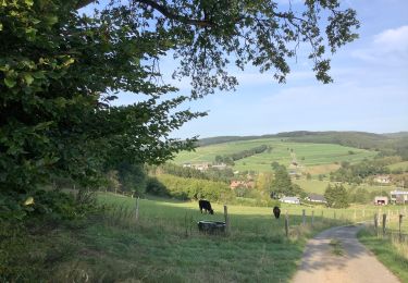
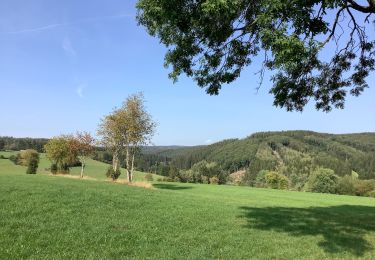
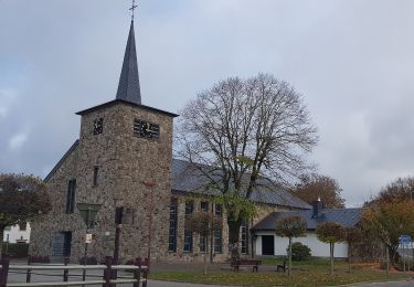
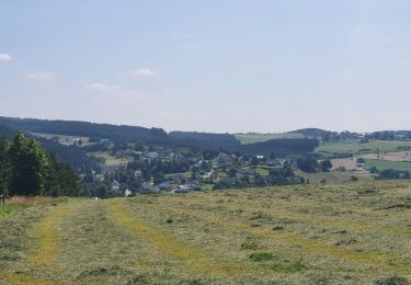
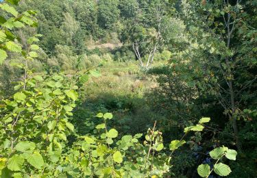
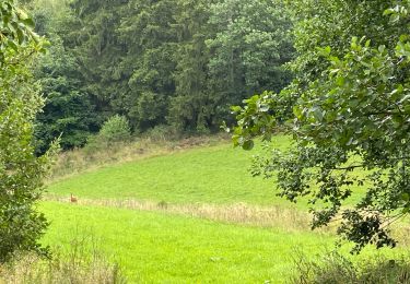
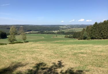
A la recherche de tranquillité, d’air frais, de vues imprenables mais avec un peu de relief ? Alors ce magnifique itinéraire à travers la forêt d’Ommerscheider est fait pour vous. Le départ commence par une montée assez raide pour arriver sur les hauteurs de Schönberg. Vous continuez, sans trop de difficulté, à travers les bois pour arriver au paisible village de Meyerode. Un superbe panorama s’offre à vous, profitez du cabanon pour vous octroyer une petite pause tout en respectant la propreté des lieux. Après avoir passé le village, remontez la route vers la forêt d’Ommerscheider. Vous passez devant le Mémorial Eric Fisher Wood, jeune soldat ayant perdu la vie en 1945, à l'âge de 26 ans en se battant seul contre les troupes allemandes. Sur le chemin, vous trouverez également une aire de repos couverte, où vous pourrez confortablement profiter de cet endroit idyllique en pleine nature. Vous longez ensuite l’eau en descendant tranquillement le sentier avant d’attaquer une côte assez raide. Le reste de la balade se poursuit sans trop de difficulté le long de l’eau jusque Schönberg.
Points-nœuds à suivre : 41-13-37-40-44-43-42-41

Elevation profile

Positioning

Country:
Belgium
Region :
Wallonia
Department/Province :
Liège
Municipality :
Saint Vith
Location:
Schönberg
Start:(UTM)
305153 ; 5574379 (32U) N.

Trails nearby

Trail On foot Buchet - Bach-Pfad - Photo
On foot
PRO

On foot

Easy
Buchet, Rhineland-Palatinate, Eifelkreis Bitburg-Prüm, Germany
4.8 km | 5.9 km-effort
1h 20min
No
Trail Snowshoes Büllingen - Manderfeld (PVDB) - Photo
Snowshoes
GUIDE
Peter.vdbergh

Snowshoes

Medium
Büllingen, Wallonia, Liège, Belgium
5.3 km | 6.6 km-effort
1h 44min
No
Trail On foot Saint Vith - Wanderweg 5 - Weberbach - Photo
On foot
PRO

On foot

Easy
Saint Vith, Wallonia, Liège, Belgium
7.2 km | 9.1 km-effort
2h 4min
Yes
Trail Walking Saint Vith - rando schoenberg 20/07/2021 - Photo
Walking
japy54

Walking

Medium
Saint Vith, Wallonia, Liège, Belgium
20 km | 27 km-effort
5h 2min
Yes
Trail Walking Saint Vith - Alersteg - Photo
Walking
emileverschueren

Walking

Saint Vith, Wallonia, Liège, Belgium
18.8 km | 25 km-effort
6h 38min
Yes
Trail Walking Amel - Herresbach  - Photo
Walking
emileverschueren

Walking

Easy
Amel, Wallonia, Liège, Belgium
14.7 km | 19.6 km-effort
5h 39min
Yes
Trail Walking Saint Vith - Alfersteg - incursion en Allemagne - Photo
Walking
emileverschueren

Walking

Saint Vith, Wallonia, Liège, Belgium
25 km | 33 km-effort
6h 48min
Yes
Trail Walking Saint Vith - Alfteg Ihren - Photo
Walking
emileverschueren

Walking

Saint Vith, Wallonia, Liège, Belgium
18.7 km | 25 km-effort
6h 47min
Yes
Trail Walking Amel - Herresbach Emile - Photo
Walking
emileverschueren

Walking

Amel, Wallonia, Liège, Belgium
16.9 km | 21 km-effort
5h 14min
Yes


Close
My subscriptions